Introducing Image Processing to Rescue Simulation Server – Shabestar Rescue Preliminary Report
Farshid Faraji, Shahin Akbarpour, Rahmat Hesami, Saeed Seyed Kazemi, Hekmat hajizadeh Asl
AI & Robotics Laboratory, Computer Group, Azad University of Shabestar Iran
Abstract For a long time, rescue simulation server have involved with the same repetitive simulators. And there were no major changes in simulation server and only minor changes have been done. So lots of solutions have been proposed to existence problems and almost everything is saturated. We believe that the introduction of image processing to RoboCup Rescue Simulation will provide further research areas and so we have proposed a new simulator to include image processing to this server.
1 Introduction
One of the main purposes of Infrastructure competitions is to develop simulators to emulate realistic phenomena predominant in disasters and also to develop intelligent agents and robots that are given the capabilities of the main actors in a disaster response scenario [1].
For a long time, teams in rescue simulation league have involved with the same repetitive problems. Each year many teams are proposing various strategies for existence problems and it seems that all methods are somewhat saturated. Participating teams in Infrastructure competition also are proposing different models and simulators based on existence problems without providing new research areas. Some of proposed simulators are Flood simulator, Flying agent, 3D simulator and others which none of them interested new researchers to this area and observing participating teams and team members for the last years proofs this fact.
To active this league and encourage many students to research in this area, it is needed to include new problems to current server. Image processing is one the main issues in robotic. We believe that, the introduction of image processing to RoboCup Rescue Simulation will take this league to a new level of intelligence.
At a serious earthquake, it takes longer time to grasp damage, even if serious damages are focused on. In such a situation, remote sensing technology can play crucial roles. Because it is time-consuming to detect damage by human eyes, it is effective to apply image processing.
The future of human and robotic operation requires robotic precursors and robotic assistants that can safely and reliably interact with their environment and effectively team with their human partners. The machine vision capabilities can enable autonomous navigation, human robot interaction, surface structure inspection, and improves remote robotic operations. Images from robot cameras provide a wealth of information for robot autonomy. Machine vision algorithms can process large volume of data and quickly extract information that is useful for autonomous activity, including planning, state estimation, navigation, and control [3].
2 Seismic Image Processing
Remote sensing technology is playing an increasingly important role in post-disaster decision support. Aero imagery can bring significant benefits to response and recovery efforts, through urban damage assessment [4].
In the case of post-earthquake urban damage assessment, remotely sensed data offers significant advantages over traditional methods of field survey – it is low-risk, and offers a rapid overview of building collapse across an extended geographic area.
After the 1995 Hyogoken-Nanbu (Kobe) earthquake, the delay of initial measures by central and local governments was pointed out. It is important to estimate and grasp damage situations during the early stage of recovery activity without depending on information sent from the interiors of the stricken area. Several methods for gathering information on damage from outside of the stricken area are available, such as aerial television imagery, aerial photography and satellite imagery [2].
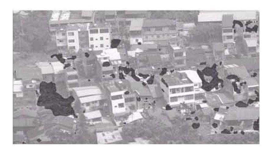
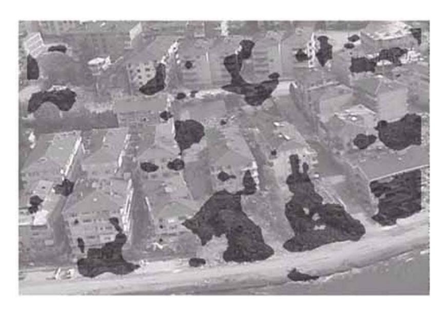
Automated detection of damaged buildings was carried out by the image processing of aerial images taken after the 1999 Kocaeli, Turkey and Chi-Chi, Taiwan earthquakes.
3 The sketch of new simulator
We are going to design a new simulator which is called Image Simulator to provide some basic images of disaster areas based on available information. These images then are sent to kernel and kernel instead of sending local information and data like buildings properties, civilians' information and etc to the agents, sends the provided images by Image simulator to them. So the agents should process the received images from kernel and extract their needed information.
For example when an agent enters inside a building, instead of sending local information like the number of civilians or their health information to the agent, some images based on that local information is created and is sent to the agent.
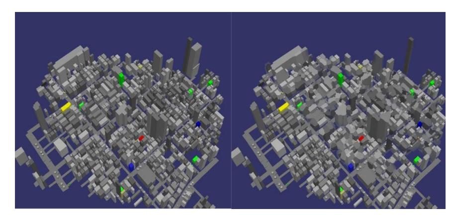
The proposed simulator will provide two kinds of image: Internal images and aerial images. Internal images refer to images of inside of buildings which an example is explained above. Aerial images are those images that are taken from a virtual flying agent. Agents by processing aerial images accurately can find out which part of city and also which buildings are damaged. Fig.2 shows a sample image of before and after a disaster which Image simulator can provide for agents.
Another feature that this simulator could have is capability of simulating virtual flying agents. Instead of adding new agent to server as flying agent, this simulator can simulate the behavior of flying agents and prepare aerial images for stationary agents. In fact there is not a flying agent in server but its operations simulated by this new simulator.
Stationary agents operations in current server are very limited particularly since communication channels were introduced. But now these agents can be more active by sending some commands to this new simulator and ask it to send aerial images of different parts of city. So new simulator based on received information from stationary agents will provide aerial images with different resolutions and altitudes. It means that only stationary agents can control flying agents and send them to different parts of city and get aerial images. Then stationary agents process received images and send useful information to moving agents.
4 Conclusion and Future Works
In this preliminary paper we have introduced a new sub simulator which includes image processing to Robocup Rescue Simulation Server. We believe that the introduction of image processing to RoboCup Rescue Simulation will provide further research areas. We will provide detailed information soon.
References
- www.robocup.org
- Hajime MITOMI, Fumio YAMAZAKI and Masashi MATSUOKA: Automated Detection of Building Damage Due to Recent Earthquakes using Aerial Television Images. Asian Conference on Remote Sensing(ACRS) ACRS2000
- http://www.nasa.gov
- B. J. Adams, IMPROVED DISASTER MANAGEMENT THROUGH POST-EARTHQUAKE BUILDING DAMAGE ASSESSMENT USING MULTITEMPORAL SATELLITE IMAGERY.