Design decisions of the SEU-RedSun Rescue 2011 Team on the Challenges of the Virtual Robot competition
CHEN Muyuan, LUO Yao, LING Xintong, LV Yajun
Southeast University, Chien-Shiung Wu College, Nan Jing 210096, China; Southeast University, School of Electronic, Nan Jing 210096, China
Abstract This discussion paper highlights the design decisions of the SEU-RedSun Rescue Team on the challenges imposed by the 2011 competition. The SEU-RedSun Rescue Team focus on SLAM and applicability of several different robots. This paper shortly describes the main features and implementation of the SEU-RedSun rescue simulation team.
1 Introduction
The RoboCup Virtual Robot competition is a great platform for rapid prototyping in urban search and rescue scenarios with teams of robots. Generally, the problem cannot be solved by single robot, and a team of heterogeneous robots that dynamically combines individual capabilities and cooperatively solves the task is needed. Our multi-robot system will demonstrate the progress of the skills necessary for urban search and rescue, including mapping, mobility, victim finding, communication and cooperation skills. This discussion paper highlights the design decisions of the SEU-RedSun Rescue Team regarding the challenges of the 2011 competition.
2 Our Goal
The main goal of our team will not change much despite of the simplification of the rule in this year's competition. The aim of our team is to develop a system in which all of the rescue robots can make decision by themselves. The system was designed to have a hierarchical structure, with each component functioning independently. The robots all have the ability for mobility, exploring, victim finding, communication and cooperation. In addition, it is hoped that the system and underlying mathematics can be portable to the real robots with minor modifications.
Robots can make decisions on their own. However, in some special circumstances, they may also be controlled by human operators through the Wireless Communications Server. All control commands are sent via the base station.
Considering the remove of sub-problems in this year's rule, our team will focus on the searching of victims. We develop more precise simultaneous localization with multiple sensors, as well as a mapping algorithm based on probability theory which adds to the robustness in complex environment. We also use a new path finding and exploration algorithm which leads to more careful search for victims.
3 Path-Planning and Exploring
The mapping algorithm we used in the previous years is mainly based on line matching. It works well in structural environment but behaves unsatisfactorily in distinguish barriers of complex figure, and makes it quite difficult to apply the algorithm to the real robot where noise and interference are much more serious. To solve these problems, we develop an algorithm rely on probability. Since the interval of each frame is quite short, we can get a large amount of data describing the same area. In common algorithms, only the first frame of these data are used, which might be affected by noise or imprecise localization and thus leads to errors in mapping and later work. But in this probabilistic algorithm, we make full use of all those data. An obstacle is confirmed only when a certain percentage of data suggest its existence. This largely reduced the ambient noise and the effect of imprecise localization. Besides, this adds to the robustness against tough environment, and it can be proved that map created by this mapping algorithm will converge to the real map when the amount of data is enough. In addition, since the algorithm is no longer based on line matching, it can now distinguish obstacles of irregular figure, which may enhance its performance on real robots.
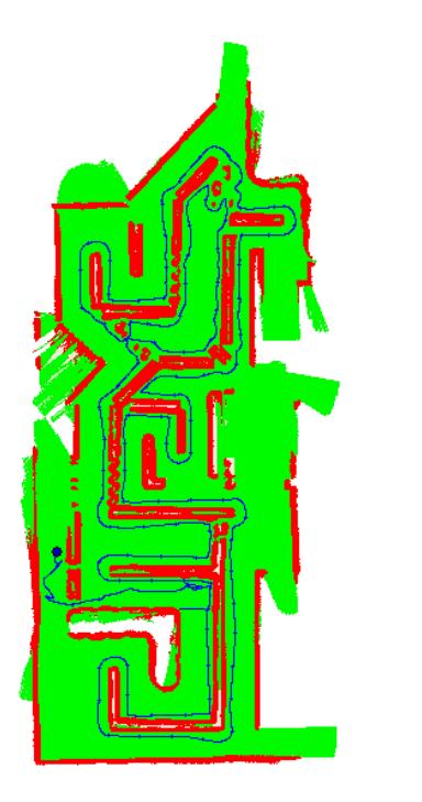
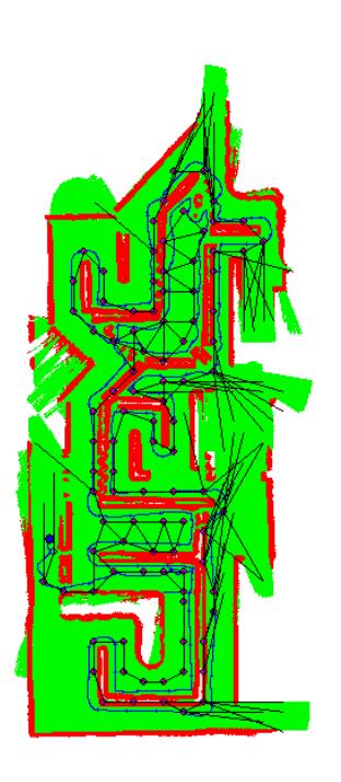
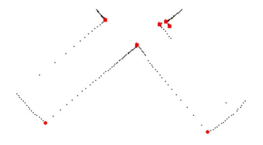
Similar to occupancy grids, the algorithm above provides an intuitive representation of the geometry of a robots physical environment. The greatest drawback, however, is that its space and time complexities grow exponentially with the grid resolution. Thus, we tried a special method of path-planning (we call it "follow-the-wall" or FTW), based on obstacle-recognition [Figure 1]. The advanced version of this method behaves just like a topological map [Figure 2], but is much more simplified.

4 Wireless Communication
Wireless Communication plays a very important role in transferring variety information among robots such as sharing the victim position and map information. We must create a structural level information management mechanism. Firstly, the base information is received from the connection layer, the connection layer parse the message for the first time and then send the package message to the message management. Secondly, the message management parses the message for the second time, and decides which message should be transmitted to the other robots, which message is unusable, which message should be updated to own Disaster Space and how to update the Disaster Space. The soon message management worked, the robot could decide how to work in the environment using the information stored in the Disaster Space.
Message type we used is listed below:
- Control messages by human operator which are sent from base station to control the robots straight.
- Disaster Space sharing information which is used to share the Disaster Space with other robots.
- Victim message
- Parameters of control center, the base station as the center will decide some parameters for all the robots.
- Cooperate message
In some situation, it is too far for a robot to send information directly to the base station. However, the information could be transferred by another robot. Link State Routing algorithm is used in our system. In the Disaster Space of each robot, a routing table is stored and updated every several cycles. Using the routing table, each robot knows how to send the information to the base station.
5 3D Map Building
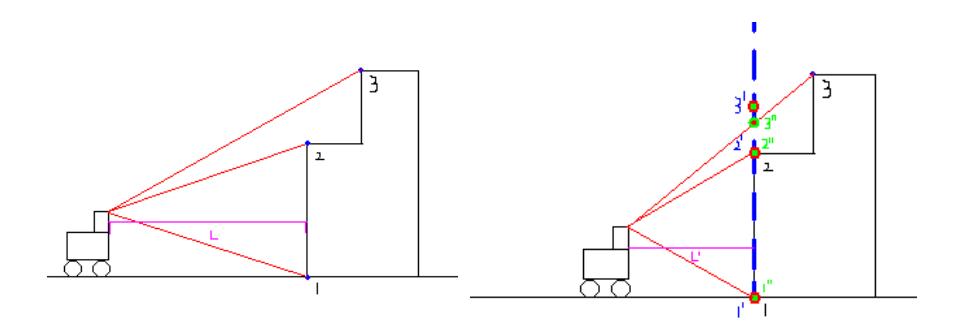
The information we captured in the previous years is mainly based on 2D laser range scanner. This year, our Team uses both scanners and camera to acquire environment information. And we capture the feature of the picture information from the camera. As the Robots can locate precisely and move effortless, we analyze the position changes of feature points in the different frames. In this way, we can transform the information of camera to the 3D space and connect the points to build the 3D map.
Step
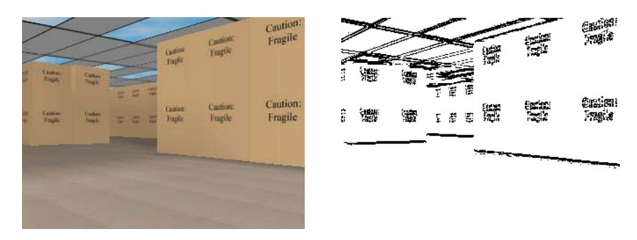
1.Analysis of the image data from the camera.
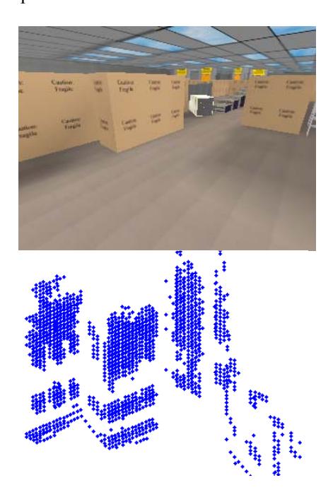
We calculate the module M of RGB vector difference of the longitudinal adjacent points. If the module M is greater than the threshold M0, then mark the point. Like that, we can convert a picture in a frame to some feature points [Figure 4].
6 Application in real robots
Our school has persisted with real robot rescue research, since the end of 2008. Most algorithms, developed on the virtual platform, has been transplanted to real robot and proven to be effective after being revised. We refer the performance of our program to meet real-time demand in real robot rescue as our ultimate goal.
7 Future works
In this paper, we highlight several new improvements in our current work. The update covers 3d SLAM, information merge and path-planning. While the newly achievement provide great hope for the future, many works are left to be done. Among them, multi-robot cooperation and victim detection ought to be emphasized.
References
- Wang, J., Balakirsky, S.: USARsim-manual3.1.1. (2007)
- Murphy, R., Casper, J., Micire, M., Hyams, J.: Mixed-initiative control of multiple heterogeneous robots for usar. Technical report, University of South Florida (2000)
- Balakirsky, S., Carpin, S., A.Kleiner, Lewis, M., Visser, A., Wang, J., Ziparo, V.: Towards heterogeneous robot teams for disaster mitigation: Results and performance metrics from robocup rescue. Journal of Field Robotics (2007)
- Howie Choset, Keiji Nagatani.:Topological Simultaneous Localization and Mapping (SLAM): Toward Exact Localization Without Explicit Localization. IEEE Transactions on Robotics and Automation (2001)
- R Kümmerle, B Steder, C Dornhege, M Ruhnke.:On measuring the accuracy of SLAM algorithms. Autonomous Robots (2009)
- Arturo Gil, Óscar Reinoso, Mónica Ballesta and Miguel Juliá.:Multi-robot visual SLAM using a Rao-Blackwellized particle filter. Robotics and Autonomous Systems (2010)
- J Yu, Y Tang, Z Cai.: Monte Carlolocalization for mobile robot with the improvement of particle filter. Intelligent Control and Automation (2008)