YILDIZ Team Description Paper for Virtual Robots Competition 2011
Sırma Yavuz, M. Fatih Amasyalı, Muhammet Balcılar, Adem Güçlü, Aykut Münük, Erkan Uslu, Zeyneb Kurt, Ozan Özışık
Yıldız Technical University Computer Engineering Department Beşiktaş, İstanbul, 34349, Turkey
Abstract This paper is a short review of technologies developed by YILDIZ team for participating in RoboCup 2011 Virtual Robot Competitions. A short description of localization and mapping, navigation and victim detection techniques that are being developed and the initial results of the algorithms are given.
1 Introduction
Probabilistic Robotics Group of Yıldız Technical University, which consists of a team of students and academicians, has been working on autonomous robots since its establishment in 2007. Autonomous robots can perform desired tasks without continuous human guidance which is necessary for Urban Search and Rescue area [1]. Urban Search and Rescue, which is a challenging area of robotics, still in the early years compared to other areas and waiting for many new tactics, techniques and strategies to be unfold.
Development strategy of our team has two stages. At the first stage the modules solving the problems of localization and mapping, navigation and victim detection are being developed and tested independently for a single robot. At the end of the first stage one robot will be able to solve all of the problems involved. The second stage of the development requires a multi-robot coordination system to be formed. Upon completion of these stages the system will be tested and improved using several robots. Our team also aims to remove the barriers between virtual and real robots, and utilize the codes on real robots.
2 Our Goals
As this is the first year of our team, we concentrate on developing a system in which all robots can make decisions by themselves, this system is planned to be used by both our real robots and virtual robots.
The system is designed to have a hierarchical structure, containing different modules responsible of different jobs. Every fundamental part of the main problem divided into modules which can function independently, and the main system runs the communication and the coordination. Normally, our virtual robots intelligent enough to explore the area, find the victims and construct a map. Each robot can directly communicate to other robots within its communication range. Since the number of robots will reduce as they park nearby the victims found, they will share information whenever possible.
The team members and their contributions are as follows:
Multi robot exploration, path planning : Ozan Özışık, M. Fatih Amasyalı Victim detection : Aykut Münük, M. Fatih Amasyalı
Control and monitor interface : Adem Güçlü, Erkan Uslu Communication, information sharing : Muhammet Balcılar Fastslam algorithm : Zeyneb Kurt, Sırma Yavuz Supervising, system design : Sırma Yavuz, M. Fatih Amasyalı
3 System Overview
The main software modules of the system are localization, mapping, navigation, communication and victim detection. Robots on their own have all those modules equipped and ready-to-use, there is also a multi-robot coordination module covering them all. As the ground robots we use the Pioneer 3AT model. The sensors to be used are determined as Hokuyo URG04L model laser scanner, camera, ultrasonic, encoder, touch and odometry sensors.
4 Exploration Strategies
For the autonomous exploration of the environment a gap search algorithm will be used. Unexplored areas of the environment (gaps) are determined by comparing the succeeding laser measurements. Exploration will continue until there are no unexplored areas in the environment.
To determine the distance between the gaps and to plan the motion of the robots A* and Artificial Potential Field approaches will be used together. A* algorithm is used to calculate the distances between the robots and the gaps; a cost function is used to optimize the gain of a gap and the cost of the journey. We still have some work to do to run A* algorithm in real time.
As a requirement of the new competition rules, one robot will be parked near each victim found. Each robot is programmed to park when it founds a victim and to share the information it holds with other robots within its communication range. This information transfer is two-way to allow the robots to carry as much as information as possible.
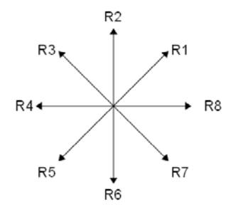
Each robot has unique default target direction information as shown in Fig. 1 for eight robots. This default target direction information is included in gain calculation to direct the robots towards different directions to explore different areas.
5 Simultaneous Localization and Mapping
To generate a map of the environment and to determine the positions of the victims we use SLAM algorithms. We are able to produce reliable sensor-based maps using FastSlam and EKF Slam Algorithms [2, 3, 4]. For the mapping EKF based FastSLAM [5] algorithm is preferred. Each scan of the laser sensor returns 184 points which are considered as landmarks. The map and pose of the robot are estimated using the range measurements obtained by robot and the control signals that make robot move. In Fig. 3, a sample map generated in USARSIM environment [6] is given.

6 Victim Detection
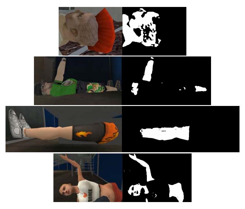
Victim Detection module is used to detect victims. During the exploration victims found are marked in the map by using victim detection module. Normally victim detection module can be thought as an independent part on its own, but as locations are need to be known, victim detection module can be considered as a sub part of localization and mapping. The main image processing algorithms to be used for victim detection are sobel edge detection and connected component labeling [7, 8]. HSV color space is used for better skin tone detection. Since the skin colors of the victims may be different from each other, both HSV and YCbCr color space transformations are obtained and combined to get the best results. The combined results obtained from two color spaces generated better results, compared to the results obtained from any single color space. To remove the noise a 5x5 mask is used on the images. Fig. 4 shows the original victim pictures and the areas determined as skin on those pictures by our algorithm.
7 Communication and Control
Communication is the main part of the system which plays role in both between robot-robot and robot-operator tasks. Robot path planning and information sharing are handled through a wireless communication system, which also listens to commands from operator. An interface, which will fulfill all requirements of all possible situations, is under construction. This interface is planned to be clear, efficient and useful.
There are various systems in nature showing intelligent behaviors without having a central decision mechanism. Immune system or social bugs are the examples of such systems [9]. Based on this reality we have adopted an approach where each robot can take its own decisions. This approach will allow the robots to continue to work on the tasks even when they are not able to communicate with the base-station or in cases that the base station is out of order. This does not mean robots not having any knowledge regarding their team members; they will continue to communicate between themselves to be able to operate more efficiently but they will not get lost in case of a communication interruption. This approach considers the base-station as a stationary robot, the base-station and consequently the operator is aware of the situation of other robots. In absence of a base station, this approach allows the robot team to continue to run.
Communication between the robots is realized through the WSS. Since the base station is considered as a stationary robot, the communication between the robots and the base siltation is also realized through the WSS.
Since the system is designed to be fully autonomous, robots are not controlled from a center.
8 Real Robot Application
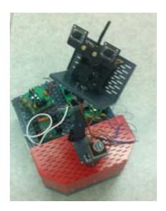
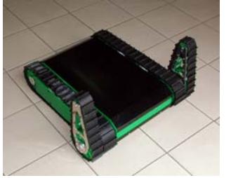
Since our team also aims to participate the real robot competition; we pay great attention to the portability of our code. We are developing two different models for real robot competition. They will share common base code developed for the simulation league ones. Our fully autonomous robot PARS, designed to be used in the yellow arena, is shown in Fig. 5.
9 Conclusion
In this paper, we give an overview of our team's design decisions. Modules that construct the system are specified and tried to be analyzed. As this is our first year in this area, the modules are still under development. The experience we hope to gain from virtual robot competition will allow us to improve our algorithms. This experience will also contribute our work on real robots.
References
- Thrun, S. , Burgard, W. and Fox D.: Probabilistic Robotics, The MIT Press, Cambridge, Massachusetts, 2005
- Özışık O., Yavuz S.: An Occupancy Grid Based SLAM Method", IEEE Computational Intelligence for Measurement Systems and Applications (CIMSA 2008), İstanbul, 2008
- Kurt Z., "Development of Intelligent SLAM Algorithms, Master Thesis, Yıldız Teknik Üniv., 2007
- Özışık O.:Simultaneous Localization and Mapping with Robot Team, Master Thesis, Yıldız Teknik Üniv., 2010
- M. Montemerlo, S. Thrun, D. Koller, and B. Wegbreit. FastSLAM: a factored solution to the simultaneous localization and mapping problem. In Proceedings of the AAAI National Conference on Artificial Intelligence, p. 593-598, 2002
- Wang, J., Balakirsky S., USARSim-manual_3.1.3
- Burion S., Human Detection for Robotic Urban Search and Rescue, Diploma Work 2003/2004, Instıtut De Productıque Robotıque (IPR) – VRAI-Group, 2004
- S. Bahadori, L. Iocchi. Human Body Detection in the RoboCup Rescue Scenario. First International Workshop on Synthetic Simulation and Robotics to Mitigate Earthquake Disaster, 2003
- Melanie Mitchell, Complexity: A Guided Tour, Oxford University Press, p.4-10, 2009