RoboCup Rescue 2021 TDP Virtual Robot Simulation ATR (US)
Jong-Hoon Kim, Xiangxu Lin, Saifuddin Mahmud, Alfred Shaker, Irvin Cardenas, Marcus Arnett, Sara Roman, Gokarna P. Sharma, Redwanul Haque Sourave
Advance Telerobotics Laboratory, Kent State University, USA
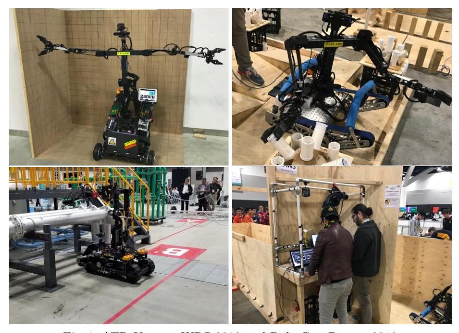
Abstract ATR Kent is a research team from the Advanced Telerobotics Research (ATR) Laboratory at Kent State University, located in Kent, Ohio, U.S.A. The ATR lab is focusing on developing and nourishing nextgeneration technologies that will bring people from around the world closer together. These are technologies that relate closely to "Telepresence Robotics", and "Immersive Experiences" such as those afforded by virtual reality. With the developed technologies, the ATR Kent team have participated in many robotics challenge such as World Robot Summit (WRS) 2018 in Tokyo Japan, RoboCup 2019 in Sydney Austria. The 2021 RoboCup Rescue Simulation League presents us an opportunity to continue in expansion of our research about robot simulation, to share our knowledge with fellow competitors, to aim the ultimate goal of innovating the field of robotics.
1 Introduction
ATR Kent, of Kent State University, is a competition team with backgrounds in Advanced Telerobotics Research. We focus on interaction and immersion within the realm of robotics, applying our methodology to Telebot, a serial of disaster response robot which was developed for the WRS 2018 Disaster Response Competition and RoboCUp Rescue Robot League. The virtual robot simulation competition of RoboCup presents us with an opportunity to continue improve our simulation research.
In the past, the Advanced Telerobotics Research Lab has mainly focused on improving the control and operation of physical robots. Past projects include a tele-operation suit that allows an operator to remotely control the torso of a robot, a Virtual Reality control interface for a remote robot's head, Simulation based multiple robot planning system architecture and etc. RoboCup gives ATR Kent an opportunity to continue research within the realm of robotics simulation, as well as improve the community with our unique approach to robotics.
Recent lab publications include: Telesuit: An Immersive User-Centric Telepresence Control Suit, Engage/Disengage: Control Triggers for Immersive Telepresence Robots, Towards an Ethical Framework for Robot Development. and Performance Comparison of NVIDIA accelerators with SIMD, Associative, and Multi-core Processors for Air Traffic Management.
2 Team Members
ATR Kent is comprised of all levels of researchers at the university level. Members range from being early in their undergraduate education to nearing the end of their PhD tenure. This gives the lab a dynamic range of skills and experiences. The ATR Kent RoboCup Simulation League team is composed as follows:
- Jong-Hoon Kim -Advisor Professor
- Gokarna P. Sharma -Senior Adviser
- XiangXu Lin Team Leader
- Irvin Cardenas System Architecture
- Alfred Shaker Drones
- Saifuddin Mahmud Victim Identification
- Redwanul Haque Sourave Victim Identification
- Marcus Arnett Control Interface
- Sara Roman System Architecture
3 System Overview
Our research and testing are conducted on several machines, each running Ubuntu 16, allowing for access to both ROS Kinetic and Melodic. The specific hardware varies from machine to machine. Thus, we are able to test our applications with several different levels of computing power.
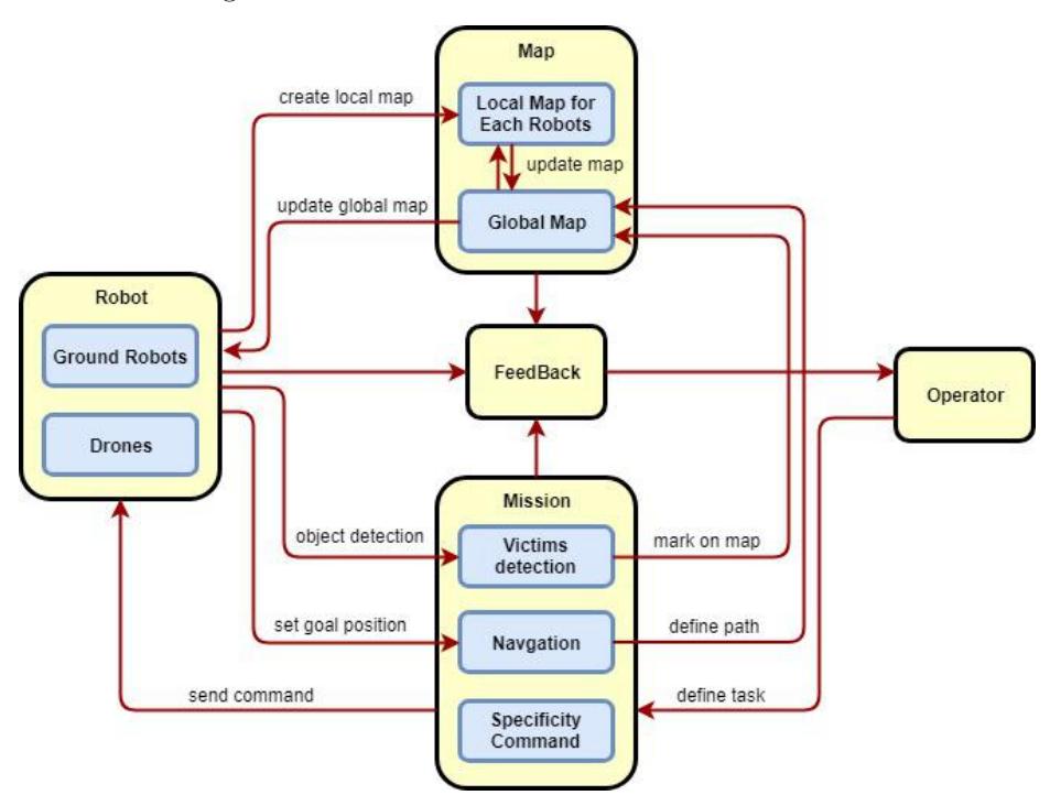
The overall system architecture and the execution flow is illustrated in Fig. 2. The system consists of two sets of robots: Ground Robots and Drones. Both of the sets have the function of creating and exploring the map, as well as finding the victims. Due to the nature of drones, they can provide fast travel speed to produce faster mapping, with some compromises in accuracy. During the period while the drone(s) is exploring the map, it will also detect potential victims along the way and mark the location on the map. The ground robot(s) assignment is then to reach the potential location of victims after receiving the data provided by the drone on the map. It also prioritizes each location of the detected potential victims by drone and calculates which path to take and which location to go in order to spend the minimum amount of time to achieve maximum performance.
The following subsections describe each module in more details.
3.1 Mapping
During the process of path planning, the robots continuously learn about the environment. Simultaneous Localization and Mapping (SLAM) allows for a robot to navigate an environment efficiently by creating a local representation of itself on a 2D map.
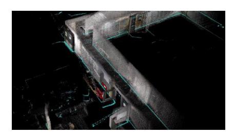
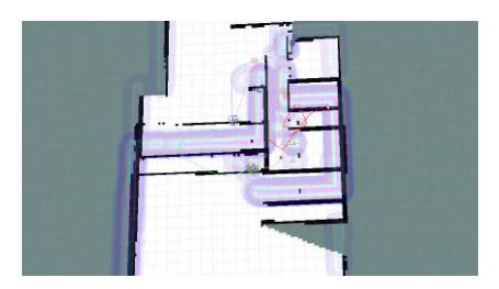
Mapping with Drone(s): Our robot team will be comprised of several different robots, with a range of form factors. Thus, it is essential to have separate mapping algorithms that correspond to the design of the robot. We are using PX4, an open source flight control software for simulated and real drones, as well as other unmanned vehicles. We plan to use the OctoMap library to dynamically generate volumetric 3D environments from sensor data. This data is then used by the simulated drone to navigate the environment safely and avoid collision. We use the Gazebo Rotors Simulator library and ROS. MAVROS is the officially supported bridge between ROS and MAVLink protocols used by PX4 that we will use in this simulation. Additionally, we plan to use the rtabmap ros (Real-Time Appearance-Based Mapping) as shown in Fig. 3 package for the 3D/2D mapping by drone. The rtabmap ros package is a RGB-D SLAM approach based on a global loop closure detector with realtime constraints. We can use the rtabmap ros package to generate a 3D point clouds of the environment as well as to create a 2D occupancy grid map for the navigation. Then we will apply rrt exploration Fig. 4 on top of given 2D map to calculate possible path for robot to autonomous travel inside the map.
Mapping with Ground Robot(s): As mentioned above, our multi-robot team requires separate modules depending on the robot's design. We plan to employ P3AT for our ground robot. The algorithms used for map production in these robots are as follows:
We are using rrt-exploration as our initial approach for the ground robot mapping algorithm. It applies a Rapidly-Exploring Random Tree (RRT) algorithm to different robots, and then creates a separate map for each individual robot. The maps will then be merged via map merger ROS package. Additionally, we plan to extend our methods by using the explore lite package available in ROS. The explore lite package provides ROS node for autonomous exploration also based on the Frontier search algorithm. Unlike other similar packages, explore lite does not create its own costmap, which makes it more efficient and lightweight.
3.2 Map Integration
Following what we describe above, each robot generates a partial map during the exploration phase. Then we merge the maps to make a general map that is available for all robots. We are using the 'multirobot map merge' package for ground robots to merge the separate maps into one, and 'map merge 3d' package for drones. We can then cross compare these two type of merged maps to achieve better localization results.
3.3 Navigation
For the ground robot, we use 2d navigation stack as the foundation, which take input from odometry, sensor message, and a goal pose to give a safe velocity command that are sent to a mobile base.
Drone navigation will be done using the PX4 software package that uses MAVROS, the official ROS package for interfacing with MAVLink. This allows for dynamic navigation based on the previously talked about dynamic octomapping. This package also includes tools for collision avoidance that we utilize to make sure the drone doesn't get stuck or damaged.
3.4 Victim Detection
For victim detection, we will be using You Only Look Once (YOLO) object detection algorithm to identify potential victims in the environment. It loads each image only once and applies a single neural network to the entire image. The network will then divide the image into regions, then predicts bounding boxes and probabilities for each region. We will implement this algorithm on both ground and drone robots. The drone will first give potential location of victims, and then the ground robot will go to each location to have a closer look at each object to determine if it is really a human or not.
For heat detection, we will be using color edge detection algorithms through OpenCV over thermal images to identify whether the victim is alive or not. If the colors detected are not close enough to the typical colors values seen on the living, the victim will be declared dead.
For sound detection, we plan to run voice activity detection. For every distinct sound we pick up, we plan to compare it with a trained model that will identify whether it is a voice or not. In order to train that model we will use several voices of different rangers to improve the voice activity's detection.
4 Robot Models
We plan to implement two different robots in our simulation environment: Pioneer 3-AT(p3at) for ground robot and hector quadrotor for drone. The p3at is a research robot developed by Pioneer, and serves as a platform for four-wheeled robot development. Hector quadrotor is a simulated quadrotor that have complete modeling, control and simulation of quadrotor UAV systems.
Table 1: Robot List
| Name | Type | Sensors | Amount |
|---|---|---|---|
| p3at | Differential Hokuyo, thermal camera | TBD | |
| hectorquadrotor | Drone | Hokuyo, thermal camera | TBD |
5 Conclusion
We at ATR Kent are excited for the opportunity to participate in the 2021 RoboCup Rescue Simulation League. It serves as an excellent opportunity to improve our simulation core within the lab. Our knowledge from past competitions will be implemented into this new adventure. We hope to share our approach to robotics with other competing teams and accelerate the field of robotics.
References
- explore lite documentation, http://wiki.ros.org/explore_lite
- map merge 3d documentation, http://wiki.ros.org/map_merge_3d
- Octomap models with ros, https://dev.px4.io/en/simulation/gazebo_octomap.html
- Open source for drones, https://px4.io/
- Pioneer 3-at documentation, https://cyberbotics.com/doc/guide/pioneer-3at
- Ros kinetic, http://wiki.ros.org/kinetic
- Ros melodic, http://wiki.ros.org/melodic
- Ros navigation documentation, http://wiki.ros.org/navigation
- rtabmap ros documentation, http://wiki.ros.org/rtabmap_ros
- Ubuntu, https://www.ubuntu.com/
- Cardenas, I.S., Vitullo, K.A., Park, M., Kim, J.H., Benitez, M., Chen, C., Ohrn-McDaniels, L.: Telesuit: An immersive user-centric telepresence control suit. In: Proceedings of the 2019 ACM/IEEE International Conference on Human-Robot Interaction. HRI '19, ACM, New York, NY, USA
- Durrant-Whyte, H.F., Bailey, T.: Simultaneous localization and mapping: part I. IEEE Robot. Automat. Mag. 13(2), 99–110 (2006)
- Dutta, S., Chaudhuri, B.B.: A color edge detection algorithm in rgb color space. In: 2009 International Conference on Advances in Recent Technologies in Communication and Computing. pp. 337–340 (Oct 2009). https://doi.org/10.1109/ARTCom.2009.72
- Furrer, F., Burri, M., Achtelik, M., Siegwart, R.: Robot Operating System (ROS): The Complete Reference (Volume 1), chap. RotorS—A Modular Gazebo MAV Simulator Framework, pp. 595–625. Springer International Publishing, Cham (2016). https://doi.org/10.1007/978-3-319-26054-9_23
- Horner, J.: Map-merging for multi-robot system (2016), https://is.cuni.cz/webapps/zzp/detail/174125/
- Kanyok, N., Kim, J.H.: Towards an ethical framework for robot development. SPRINT Industrial and Maintenance Robotics Conference (Nov 2018)
- Kim, D.Y., Cardenas, I.S., Kim, J.H.: Engage/Disengage: Control Triggers for Immersive Telepresence Robots. In: Proceedings of the 5th International Conference on Human Agent Interaction - HAI '17. pp. 495–499. ACM Press, Bielefeld, Germany (2017). https://doi.org/10.1145/3125739.3132603
- Meyer, J., Sendobry, A., Kohlbrecher, S., Klingauf, U., von Stryk, O.: Comprehensive simulation of quadrotor uavs using ros and gazebo. In: 3rd Int. Conf. on Simulation, Modeling and Programming for Autonomous Robots (SIMPAR). p. to appear (2012)
- Redmon, J., Farhadi, A.: Yolov3: An incremental improvement. arXiv (2018)
- Shaker, A., Baker, J., Sharma, G., Yuan, M.: Performance comparison of nvidia accelerators with simd, associative, and multi-core processors for air traffic management. pp. 1–10 (08 2018). https://doi.org/10.1145/3229710.3229757
- Umari, H., Mukhopadhyay, S.: Autonomous robotic exploration based on multiple rapidly-exploring randomized trees. In: 2017 IEEE/RSJ International Conference on Intelligent Robots and Systems (IROS). pp. 1396–1402 (Sept 2017). https://doi.org/10.1109/IROS.2017.8202319
- Verbiest, K., Berrabah, S.A., Colon, E.: Autonomous frontier based exploration for mobile robots. In: Liu, H., Kubota, N., Zhu, X., Dillmann, R., Zhou, D. (eds.) Intelligent Robotics and Applications. pp. 3–13. Springer International Publishing, Cham (2015)
- Ying, D., Yan, Y., Dang, J., Soong, F.K.: Voice activity detection based on an unsupervised learning framework. IEEE Transactions on Audio, Speech, and Language Processing 19(8), 2624–2633 (Nov 2011). https://doi.org/10.1109/TASL.2011.2125953