Robocup Rescue - Virtual Robots Team MRL (Iran) Team Description Paper for Robocup 2011 Istanbul, Turkey
Edris Esmaeili aliabadi, Amir Panah, Mohammad Hosein Shayesteh, Sanaz Taleghani
Islamic Azad University of Qazvin, Electrical Engineering and Computer Science Department, Mechatronics Research Lab, Qazvin, Iran
Abstract This paper describes the main features of the MRL Virtual Robots team which intends to participate in Robocup 2011 competitions. Virtual Robots is an environments that a combination of state of the art algorithms of Robotics and Artificial Intelligence fields are needed to deal with its challenges. In the following we describe our approach for the main challenges such as Simultaneous Localization and Mapping (SLAM), Multi Agent Coordination and Exploration, Communication Infrastructure, Victim Detection and etc.
1 Introduction
Nowadays Robotic and Artificial Intelligence are in the center of attention of many researchers. USARSim provides us with an environment in which the conjunction of these two fields occurs. In this environment, a disaster (usually an earthquake) is being simulated in indoor and outdoor scenarios. The goal is to gather a map of a previously unknown environment which would provide information about the situation, victims, damages and etc. To overcome the goal, a combination of the state of the art algorithms of different fields needs to be implemented. These fields include Localization, Mapping, Machine Vision and Image Processing, Robot Navigation, Robot Communication, Multi-Robot Coordination, Modeling and etc. In this paper, we describe our approaches to these different challenges which we would use to participate in Robocup 2011 Virtual Robots Competitions.
Our team members and their contributions in team are:
Edris Esmaeili : Coordinator and AI Developer
Sanaz Taleghani : SLAM
M.Hosein Shayesteh : Communication Infrastructure Amir Panah : Vision & Victim Detection Sepideh Shahmoradi : Software Developer
2 Localization and Mapping
2.1 Localization
Scan matching as a basic part of SLAM has a key role in localization [1] and even mapping of mobile robots. Our innovative method named ICE [2, 3] matching presents a quick and also an accurate method to solve the challenges of this problem. Novelty in defining new features, matching mechanism and new state estimation approach congregated in this method creates a robust practical technique. Comparison with some high quality scan matching methods from different viewpoints illustrates the performance of ICE matching. It was applied besides Grid based mapping to generate fine-tuned maps to compare with slam methods.
2.2 Mapping
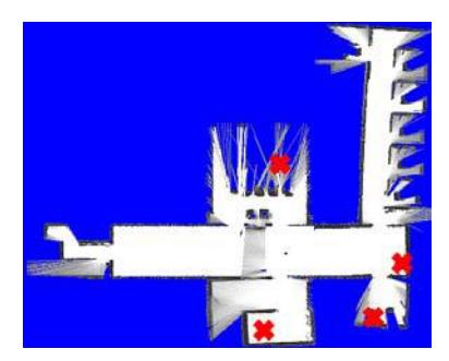
While moving through an environment, the robot is required to derive a map from its perception. We've used to apply a Grid Mapping method which has been also improved by ourselves. This algorithm received the sensor data from each robot in a real time way that had a large overhead on the center, but it had also an advantage which is noted here: After the disconnection of robots from center we won't lose the map that generated until now. We are currently using a new algorithm which contains both advantages that is based on line produced by feature extraction methods of our innovated localization algorithm (ICE) which are sent to center and we create the map based on these lines.
3 Exploration And Navigation
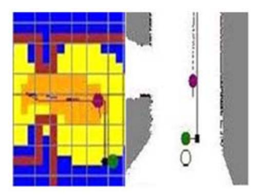
An Efficient exploration of unknown environments is a fundamental problem in mobile robotics. We propose a multi layered grid map (MLEGM) [4] whose cells are represented by 3 abstract layers. The Value of each cell in first layer is calculated by range finder's free beams. In other layers, the Value of each cell is calculated by visual information; exploration value and information are received by other sensors' data. Next we merge the value of these layers to have a single meaning value. Then we can use this value in many purposes e.g. finding optimal path for exploration or using these values as rewards for learning purposes in Reinforcement Learning algorithms. This algorithm has some benefits from other exploration algorithms which work with information of single sensor such as frontier exploration or hill climbing exploration and etc.
4 NEW GUI
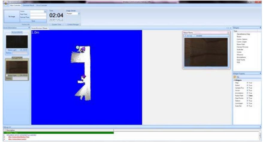
Last year, our UI was based on SlimDX and .Net Framework 3.5 and it also was capable of managing and drawing high load of data such as Simulation Environment, Victims, Robots, Robot's path and etc. But this year according to unnecessary of presentation of results as GeoTIFF we decreased the amount of graphical data and with transition of UI to .Net Framework 4 we could use the benefits of parallel programming for more reliable designing of UI.
5 Communication Infrastructure
Architecture of our communications infrastructure is as follow:
WSS Control Link layer controls sending and receiving packets via WSS application and our robot controllers, after receiving them this layer sends those packets to the Network Manager.
Network Manager Layer manages received packets from WSS Control Link and also controls two below layers too. This layer acts as a network service manager.
The duty of Communication Graph Layer is to implement routing table for sending and receiving packets between two distant robots. On this layer we make a dynamic graph according to DV (Distance Vector) algorithm.
These tables will be updated via particular messages at specific times whenever some of the links are lost or some messages cause valid changes on the table. When a change occurs, each robot must send its table to neighbors.
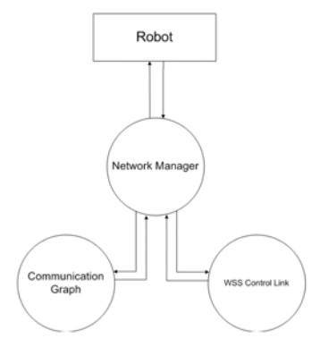
Fig. 5. DV Table of robot A
| Destination | Connected | Interface |
|---|---|---|
| A | F | NULL |
| B | F | NULL |
| C | T | A |
| D | T | B |
| E | F | NULL |
| F | T | A |
| G | F | NULL |
In figure 5, First column of this table demonstrates how the specific link to the destination robot is connected or disconnected. The second column expresses which of the neighbors is between the main robot and destination robot, if the interface robot was equal to the main robot; this fact indicates there is a straight link to the destination.
6 Victim Detection
The preliminary aim is to build an autonomous robot which is able to drive through an unstructured environment and search for victims. The one of goal VR competition is to find victims in the disaster areas and building the environment map, including landmarks of interest, therefore human responders may find their way more easily with these data if necessary. The detection and localization of victims is a high level task for our team members.
Since a rescue virtual robots operator has a large number of tasks to concentrate on, it is desirable to offload as much as possible onto the robot. There has been great progress in recent years in Computer Vision, including the automated detection of particular types of objects in image data. Therefore, it should be possible to give rescue virtual robots the capability of victims and landmarks detection autonomously, alerting the human operator as required.
For detecting the victims, the cameras and sensors provide information of the environment. Camera images can be used to automatically detect victims, independent from the Victim sensor provided by USARSim, as indicated in [5].
For the victim detection test, the robots must find, identify, and report the location of as many victims in the allotted time. The environment used for this test will not present mobility challenges but will present perception challenges. We will check based on a HOG algorithm the Body Detection approach [6, 7].
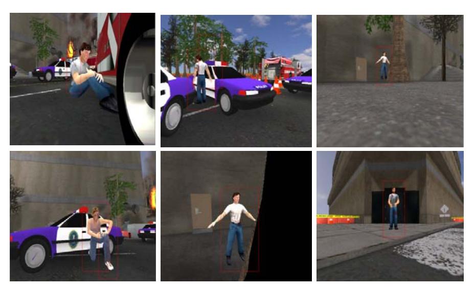
To examine such autonomous recognition, we have implemented an existing object recognition approach that uses a HOG algorithm to find known objects in a given image [8, 9, 10]. Using several hundred annotated images taken from USARSim based on UT3, containing victims, chairs, doors, walls and cars, etc. we are able to signify victims with a detection rate of 50% to 70% now. Several examples are shown in figure 6.
7 Conclusion
Our five years of working experience in Virtual Robots field lead us to an innovation about the SLAM problem and some other different method gradually. These methods are still in progress, but the promising results which we got from these methods encourage us to continue our work.
References
- Panah A., Esmaeili E., :Optimizing Robot's Movement By Localization Algorithms In Unknown Environment, 2nd Robocup Iran Open 2010 International Symposium, Tehran, Iran. (2010)
- Taleghani, S., Sharbafi M.A., Haghighat, A.T., Esmaeili, E., :ICE Matching, a Robust Mobile Robot Localization with Application to SLAM: ICTAI 2010, Aras, France. (2010)
- Sharbafi M.A., Taleghani, S., Esmaeili, E., Haghighat, A.T., Aghazadeh, O., :ICE Matching, a Novel Approach for Localization Problem: IEEE International Conference on Control, Automation and Systems 2010, in KINTEX, Gyeonggi-do, Korea, Oct. 27-30 (2010)
- Esmaeili E., Taleghani S., Panah A., :Optimizing Exploration for Mobile Robots based on Multi Layered Evidence Grid Map (MLEG), 3rd Robocup Iran Open 2011 International Symposium, Tehran, Iran.(2011)
- Visser, A., et al.: Design decisions of the UvA Rescue 2007 Team on the Challenges of the Virtual Robot competition. In: Proc. 4th International Workshop on Synthetic Simulation and Robotics to Mitigate Earthquake Disaster, pages 20–26. (2007)
- N. Dalal, B. Triggs, and C. Schmid. Human detection using oriented histograms of flow and appearance. European Conference on Computer Vision, pages 7–13. (2006)
- Wei. Jiang, Advanced Techniques for Semantic Concept Detection in General Videos. PhD Thesis Graduate School of Arts and Sciences, Columbia University. (2010)
- Flynn, H.: Machine learning applied to object recognition in robot search and rescue systems. Master's thesis, University of Oxford. (2009)
- Flynn, H., de Hoog, J., Cameron, S.: Integrating automated object detection into mapping in USARSim. In: Proceedings of the International Conference on Intelligent Robots and Systems (IROS 2009), Workshop on Robots, Games, and Research: Success stories in USARSim, pages 29–34. (2009)
- N. Dalal and B. Triggs. Histograms of oriented gradients for human detection. Proc. IEEE International Conference on Computer Vision and Pattern Recognition (CVPR'05), pages 886–893. (2005)